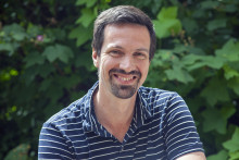
In his main line of research, Roelof Rietbroek, Assistant Professor at the department of Water Resources (ITC Faculty), focuses on using satellite observations to study sea level and the Earth's water cycle in a changing world.
‘Among other data, I use data from satellites that measure changes in the gravitational field of Earth,’ explains Rietbroek. ‘These changes in the gravity field are linked to mass transport, which includes changes in water storage on land, glaciers and so on. When the water cycle changes these masses, there are changes in the gravitational field which are visible as tiny orbit variations, which you can observe with the satellites. This way, we can map the changes over time. The Earth’s crust also deforms due to the changing water masses and this can be measured with a network of GPS stations. By combining this data, we can find out the different contributors to rising sea level, for example.’
Wetter or drier?
Rietbroek’s Vidi project is titled ‘Are watersheds getting wetter or drier?’ The scientist will use satellite observations to see how atmospheric transport of moisture and river discharge are changing the water cycle and sea level.
‘With my Vidi project, I’m moving from the ocean to land,’ says the researcher. ‘I will focus on water sheds in the North Sea and in the Greater Horn of Africa. In the Horn of Africa we see droughts even though models suggest that it should be getting wetter there. I’d like to determine how much water flows into the region and how much flows out – and how this changes over time. The global trend is that wet is getting wetter and dry is getting drier, but that isn’t necessarily the case everywhere. There is no single rule of thumb which can be applied for a given region. Therefore, I want to clarify the ocean-land exchange and model how the systems interact.’

For everyone
‘This topic is of large relevance,’ stresses Rietbroek. ‘It connects to drought related issues, and indirectly food-security. Even in Twente we experience droughts and decision makers are worried about water availability. This project won’t come up with solutions specific to Twente, but I can provide a better understanding of how our water sheds work at large.’
When it comes to research outcomes, Rietbroek sees two main goals. ‘At the end of the project, scientifically I aim to gain insights into land-ocean exchanges and how they change over time. From a practical point of view, I want to have data sets and software that people can tap into and use to, for example, validate their models or create drought indicators. Open science principles play a key role in my research. That is something I was very clear about in my Vidi proposal. Software and data from this project will be available to everyone.’
Larger steps
Getting a Vidi is a big step for Roelof Rietbroek. ‘It means we can get more research done,’ says the scientist. ‘I only have two hands and one brain, and so I cannot do everything alone. Having a Vidi means I can build a research group . We can get more done and make larger steps. I also see that the topic of my Vidi has many connections to other ITC activities. I think it can pave a path to spin-off projects both in terms of research and capacity building.’


