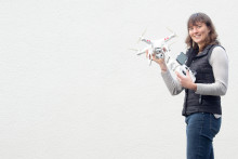
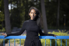
Although she admits her work can be a lot of fun, the main purpose of Gevaert’s research is to improve living situations in slums by supporting upgrading projects. 'There are slum upgrading projects, but their realization is difficult because there are often none or outdated maps of the area. With UAVs you can get very detailed information at low costs,' Gevaert talks about her project, which revolves around analyzing methods of extracting information from UAV imagery.
International life
Before she began to work with drones at ITC, Caroline Gevaert had not spent much time in the Netherlands. Even though she has Dutch parents, she grew up in the U.S. and only moved to her mother’s home country for several years. Afterwards, she quickly left for an internship in Bolivia, where she eventually stayed for two years, working in watershed management. Since she already had to learn Spanish, she acquired her Master’s degree in Valencia and, in her spare time, she also got another MSc title from the Lund University in Sweden.
'If you stay longer in one place, you really get to know the culture. That´s the real gift of it all,' says Gevaert. Her fondness for international and academic environment brought Gevaert to the UT. 'ITC has a strong reputation and I can learn a lot here, but the project also spoke to the idealistic part of me. Moreover, I get to travel a lot.' Indeed, her research allowed her to visit Africa for the first time.
Confronting
'I specifically remember stepping off the airplane into the tropical night, excited. I cooperate with the municipality of Kigali in Rwanda, where I got to fly the UAV myself. That was an awesome experience, however it was also confronting. A local woman told me that it was nice we were going to make a better infrastructure in the slums, but that it won’t change their situation. They would still be poor. That makes you see the reality.'
That is also why Gevaert enjoys being a PhD: 'I’m not only looking at how to automatically extract information from images, but also how to help people.' And in order to do that, Gevaert is working on identifying different objects on images obtained by UAVs. 'We focus on buildings, vegetation, roads, but also drainage, for instance. Later, I’d like to study changes detection and social impact. The main question now is: How far can we take it? How much information can we get from the images?'


