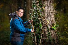
Milad Mahour, originally from Iran, is a PhD candidate at the ITC faculty of the University of Twente. His overall research is focused on supporting decision makers and farm managers with suggestions and recommendations for water requirement. In his recent paper titled ‘Tree detection in orchards from VHR satellite images using scale-space theory’, Mahour showed how detailed and reliable information is extracted from Very High Resolution (VHR) satellite images to detect individual trees. Why is detecting individual trees important?
Method able to detect every single tree
‘The study focused on the Ghazvin area in Iran, which is an important agricultural area of about 400 km2, where more than 70% of food supply for Teheran comes from,’ begins Mahour. ‘This area has one of the oldest advanced irrigation networks in the world, but water scarcity is a problem there. Each individual tree there has a value, and so it is necessary to monitor changes in each and every tree. Accurately detecting tree boundary allows us to detect water supply for the tree.’
Mahour’s study involved two orchards with trees of different types, sizes and planting patterns. ‘We included orchards with peach and walnut trees, which are important sources of nutrition as well as wood,’ says Mahour. ‘Our goal was to automatically detect the canopy of trees using VHR satellite images. We conducted the study in the middle of the growing season, when there are a lot of adjacent interlocks between the trees, but the method worked excellently and we were able to detect basically every single tree. Such a tree detection can be very useful if combined with irrigation management.’
Lots of math, programming and physics
Based on this method, it is possible to automatically extract information on crops and tree health, water requirements and to continually monitor changes in the orchards or elsewhere. ‘Thanks to the remotely sensed data, we can quickly detect problems with irrigation techniques, not to mention that this method is cheaper and less time-consuming,’ clarifies Mahour. ‘Although this application focused on agricultural area in relation to food security, this method can be applied to any other area in the world, including urban areas, because it detects trees and trees only. There is a lot of math, programming and physics behind the method.’
Was there a particular reason why Mahour chose the mentioned agricultural area in Iran? ‘Iran is my country and I love my country, so I believe I should use my scientific skills to further improve it,’ he says. ‘Besides, I know the area very well, because I worked there on a national agricultural project. I know how vital this area is and that there is a problem with water shortage, so I want to use this method for really optimal water allocation. Although, you don’t need this application here in the Netherlands, for example, it is important to me that the method is now available and scientists anywhere can use it.’
Milad Mahour’s study, co-authored by Prof. Alfred Stein and Valentyn Tolpekin, has already gained international recognition. In fact, it won the award for the best student paper at Image and Signal Processing for Remote Sensing of SPIE Remote Sensing conference 2016 in Edinburgh, United Kingdom.
The article can also be found in the latest (and the very last) issue of the UT Nieuws magazine.


